
Routes 11/A/B/C:
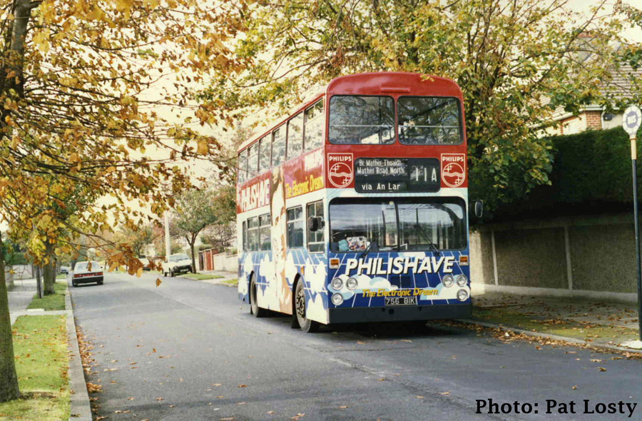
Van-Hool bodied Leyland AN68, D756, is seen at the 11A's Mather Road Terminus on the 2nd November 1986. D756 was delivered very late in 1975, and at this point was in Phillips All-Over-Advertising (AOA) for the Philishave brand. D757, see below, was also in Phillips AOA at the time but for a different product. D756 had the honour of bringing some senior executives of Phillips around for a day or two. For this it was carpeted in the lower saloon. The bus would spend a few months in Cork for further advertising exposure, and before its withdrawl in 1993 would also be painted into a National Blood Transfusion Service AOA in 1989.
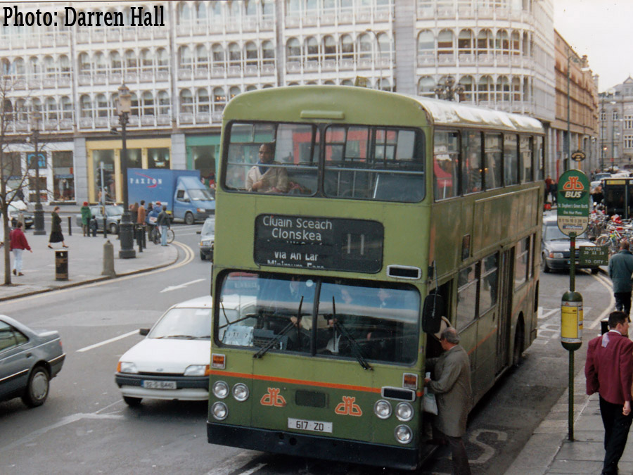
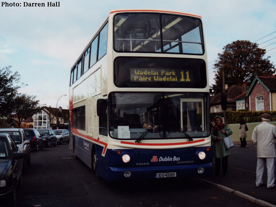
The 11 is a cross-city bus route from Wadelai Park on the Northside of the city to Kilmacud on the southside, most notably associated with the Clonskea and Whitehall areas of Dublin.
Its history stretches back to the horse-tram era. Horse trams began operation of a service to Clonskea on St. Patricks Day, 17th March 1879. They were operated by the Dublin Central Tramways Company (DCT). Operating from a terminus in College Green, in front of Trinity College, the trams operated the following route:
College Green, Dame Street, South Great Georges Street, Aungier Street, Wexford Street, Camden Street, Charlotte Street, Charlemont Street, Ranelagh Road, Sandford Road to a terminus at Vergemount.
Alexander R-bodied Leyland Olympian, RH41, is seen on O'Connell Street operating to the Clonskea Bird Avenue terminus of Route 11 on the 21st September 1994. RH41 was one a number of buses delivered in white wedding bus livery for use on private hires. It is seen here in a very attractive Irish Rail AOA. The 11, due its cross city nature, was long associated with AOA buses when these practice was performed. RH41 would only see 12 years in service with Dublin Bus, a sign of the affluent Celtic Tiger years, and is now operating as an open top bus in Cork.
The tram depot for this route was located at Vergemount; Vergemount also being the location of Clonskeagh Hospital. The Dublin Central Tramways Company merged with the North Dublin Street Tramways Company and the larger Dublin Tramways company to form the Dublin United Tramways Company in 1880.
The Clonskea trams were electrified as part of a wholesale electrification of Dublins tramways in the late 1890s. The electric trams began operation on the 1st December 1899. This saw a change in routing for the Clonskeagh trams operating to a new city terminus of Nelsons Pillar. The routing was as follows:
Nelsons Pillar, OConnell Street, Westmoreland Street, Grafton Street, Nassau Street, Dawson Street, St. Stephens Green North, St. Stephens Green East, Leeson Street, The Appian Way, Chelmsford Road, Sandford Road, Vergemount.
Alexander R-bodied Volvo Olympian, RV413, seen loading on O'Connell Street en route to Clonskea on the 26th July 1998. O'Connell Street looks almost picturesk being shrowded as it is by overhanging trees. The longstanding flora of O'Connell Street was removed as part of a large reshaping of the capital's main street that has made the road much smaller and the street more pedestrian friendly.
In 1902, just after the vast electrication of Dublins tramway network, the Dublin United Tramway Companys Secretary R.S. Tresilian went about describing each of the lines in the Dublin Tram Network in order to boost passenger numbers. Each line is described in detail, with a continuous stream of words, all contained in one single sentence. Maybe long sentences were fashionable at the time, Ulysses, James Joyces classic novel, set in Dublin only two years after this Guide was published, ends with a single sentence 12,931 words long. The description below falls well short of such heights at a respectable 303 words. These line descriptions were reprinted in a Guide to Dublin for the Worlds Fair in 1907 from which I quote:
Nelsons Pillar to Clonskea: Distance 2.5miles, cars run every 7½ minutes:
The cars start from Nelsons Pillar (close to the General Post Office), at the junction of Lower and Upper Sackville Streets, and passing through Lower Sackville Street, in which are the statues in memory of Sir John Gray, the originator of the Dartry water supply to Dublin, and of Daniel OConnell, The Liberator, this being the work of the great Irish sculptor, Foley, and then across OConnell, formerly Carlisle, Bridge, where at the junction of Dolier and Westmoreland Streets, is the statue of Smith-OBrien; passing through Westmoreland Street, and at the junction with College Street, by the statue of Thomas Moore, the great Irish poet, they come to College Green, with the statue of Grattan, the Bank of Ireland, Dame Street, on the right, and Trinity College to the left, with statues of Burke and Goldsmith in front; through the lower part of fashionable Grafton Street (the Bond-Street of Dublin), they turn off along the Trinity College Grounds, to the left, through Nassau Street to Dawson Street, where they turn to the left, passing the Shelbourne Hotel, the Protestant Archbishops Palace, the University, the Friendly Brothers and the Ormonde Clubs on the left, along the north and west sides of Stephens Green, with St. Vincents Hospital and the Royal College of Science on the left, and at the corner of Stephens Green turning into Lower Leeson Street, along which they continue past the Canal, the city boundary, and through Upper Leeson Street, Christ Church, Leeson Park, and the Molyneux Blind Asylum on the right, as far as the Appian Way, up which they turn, and proceeding along this road and Chelmsford Road into Ranelagh Road, and continue along it and Sandford Road past the branch to Milltown, to the terminus close to Clonskea village, and the river Dodder, along which are romantic walks.
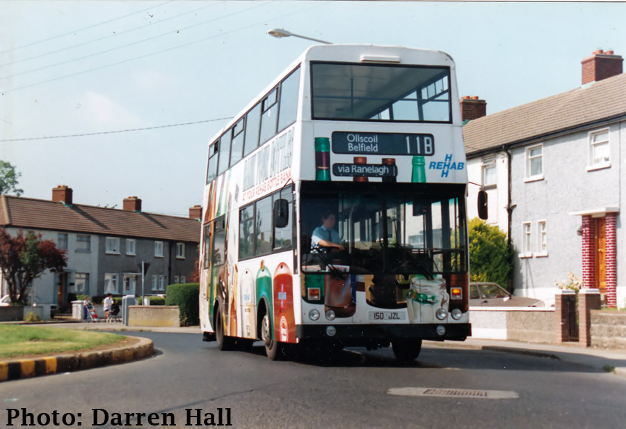
Bombadier KD150 seen on St. Pappin's Road having just left its Wadelai Park terminus bound for Belfield in the early 1990s. KD150 was one of a 10 bus batch delivered in 1982 which entered service on Route 48A. It carries advertising for Rehab, a recycling company most known in the early 90s for recyling glass bottles. KD150 received the livery late in 1991, retaining it until the Summer of 1994, the advertisement being sponsored by Irish Distillers. KD150 would spend most of its working life in Donnybrook, but was transferred to Summerhill just prior to Christmas 1995. It would spend just less than a year there being withdrawn in 1996.
The DUTC first used numbers to designate routes in 1918. Prior to this each tram just had a destination box and panels on the sides displaying the termini and a via point. In order to combat the illiteracy problem of the time, the DUTC introduced a system of symbols to distinguish trams in 1903. Trams carried these symbols above their destination scroll. For the Clonskea tram the symbol used was two overlapping yellow disks.

In March of 1918, shortages of supplies caused by low shipping levels during the war, lead to a severe shortage of coal within Ireland. An order to conserve coal was given by the Director of Cross-Channel Transport. As a result the DUTC decided to curtail and discontinue some services on Thursday 21st March 1918. The company stated at this point that it only had 28 days worth of coal at their then current consumption rates and it was necessary to conserve their supply.
One of the routes to be curtailed was the Phoenix Park to Donnybook Line via Merrion Row and Dawson Street. Therefore in order to compensate for its withdrawal, the Clonskea trams were extended to a northern terminus of Phoenix Park. The routing was as follows:
Phoenix Park (Park Gate), North Circular Road, Berkeley Road, Blessington Street, North Frederick Street, Parnell Square East, OConnell Street and as per previous routing to Clonskea.
It is important to note at this point that the 9 was a major tram route also from Phoenix Park to Donnybrook. Basically the removal of the Merrion Row service saw the duplication on this route in Donnybrook removed, while the 11 extension allowed for the required number of trams on the northern section.
Alexandra Setanta bodied Volvo DAF SB220, AD68, the highest numbered AD to be delivered to Donnybrook in the 1994 batch, is seen on O'Connell Street operating a northbound service to Wadelai Park on the 19th February 1997. This bus would see out its days in Harristown Garage, principally on the orbital 17A route and was withdrawn in 2006.
On the 16th June 1919, a new tram route 5 was introduced running from Phoenix Park to Pembroke (Merrion Road corner of Sandymount Avenue). From this date the 11 changed its northern terminus from Phoenix Park to Drumcondra. The Drumcondra terminus was at the corner of Botanic Avenue. The routing was as follows:
Drumcondra Road (Cnr Botanic Avenue), Dorset Street, North Frederick Street and as per previous routing to Clonskea.
In terms of inflation, its interesting to look at the fare structure back 80 years ago. The figures used are generated using a UK sterling inflation calculator, and then converted into Euro. However, though these numbers go to show how heavily inflated transport pricing has become, in general people have become richer than inflation rates would suggest. Back in 1928 the following fares applied:
1d (1 pence - about 13¢) would have got you from:
Clonskea to Ranelagh Junction
Ranelagh Junction to Stephens Green (cnr Merrion Row)
Stephens Green (cnr Leeson Street) to Nelsons Pillar
Grafton Street Corner to Blessington Street Corner
Nelson Pillar to Binns Bridge
Botanic Avenue to Blessington Street Corner.
1.5d (about 20¢) would have got you from:
Clonskea to Leeson Street Bridge
Leeson Street Bridge to Nelsons Pillar
Nelsons Pillar to Botanic Avenue
2d (about 28¢) would have got you from:
Clonskea to Stephens Green (Corner Merrion Row)Ranelagh Junction to Nelsons Pillar
Leeson Street Bridge to Binns Bridge
St. Stephens Green (Cnr. Leeson Street) to Botanic Avenue (Drumcondra)
3d (about 42¢)from:
Clonskea to Nelsons Pillar
Ranelagh Junction to Botanic Avenue (Drumcondra)
While 4d (about 56¢) would have taken you the whole route from Clonskea to Botanic Avenue Drumcondra.

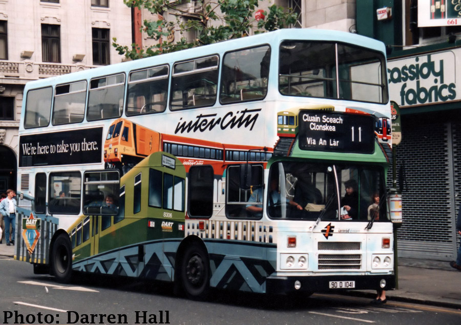
Van-Hool bodied Leyland Atlantean AN68, D785, redesignated DF785 due to it acquisition of a DAF engine is seen at the Bird Avenue terminus of Route 11 on the 21st May 1989. Denny took out this advertisement in early 1988 to celebrate Dublin's 1000th year. It featured principal Dublin landmarks silhouetted in dark blue on a white background, and featured a slogan " Happy 1000th Birthday Dublin" (see image in wheelingintheyears 1988). This slogan would be updated in April 1989 to read "The Art of Good Food for over 160 years". The livery was quite distinct and a little matchbox toy bus was sold in the this livery as a 1000th year souvenir. DF785 would be transferred to Ringsend in the 90s, and had the honour of being the last Atlantean in service at that garage, operating a Route 15B service on 22nd April 1995 (see wheeling in the years 1995 ).
The 11 was extended northwards up Drumcondra Road Upper to a terminus at Whitehall in 1930, as the section from Botanic Avenue to Whitehall was made into double track, except for a small section where the road narrows at the Cat and Cage pub. This double-track could accommodate more trams and hence route 11 was extended to Whitehall (Whitehall Garda Station Cnr Griffith Avenue).
The Whitehall line was abandoned on the 1st May 1939. This saw routes 16 and 17 converted to buses, while Route 11 was cut short to only operate between Nelsons Pillar and Clonskea. It should be noted that Route 11 had operated the curtailed routing from Nelsons Pillar to Clonskea on Sundays from at least the mid-20s, the Drumcondra and Whitehall extensions being weekday only.
A new Route 11A was started to cover the northern end of Route 11 between the city centre and Whitehall. The route was from Nelson Pillar to Griffith Avenue (Sherkin Gardens). There was no 11A timetable produced but the buses were referred to in a footnote on the first 17 bus timetable which read: "In addition to the above a frequent service of buses will operate between Whitehall (Griffith Avenue) and Nelson's Pillar."
Van-Hool bodied Leyland Atlantean AN68, DF607, is seen operating an 11A service on O'Connell Street on the 9th October 1991. This bus had been new to Clontarf and was transferred in 1986 for a brief spell in Conyngham Road, then to Ringsend before finally Donnybrook. When withdrawn it went into service on City Tour work.
The Clonskea trams were withdrawn on the 1st July 1939. Buses began running on the 2nd from Clonskea (Vergemount) to Mobhi Road (terminus at corner of Mobhi Road and Ballymun Road). This northern extension of the route saw it travel along Home Farm Road. From this date Route 41A to Walsh Road was withdrawn. Most sources indicate that the 11A stopped running also from this date however the footnote in the 17 timetable remained until the November 1939 timetable booklet, however this could have been an error by the DUTC though around this time the 11 did see a minor frequency increase from a daytime of every 5mins to every 4½mins. The 11 operated initially out of Lime Street garage, then Ringsend garage from February 1941 when Lime Street closed. It then moved to Donnybrook garage, definitely by the late 1940s, where it has operated from ever since. The full routing was as follows:
Mobhi Road (cnr Ballymun Road), Home Farm Road, Drumcondra Road Upper, Drumcondra Road Lower, Dorset Street Lower, North Frederick Street, Parnell Square East, OConnell Street, Westmoreland Street, Grafton Street, Nassau Street, Dawson Street, St. Stephens Green North, St. Stephens Green East, Leeson Street, The Appian Way, Chelmsford Road, Sandford Road, Vergemount.
The 41A was one of two DUTC services that operated to Walsh Road. It started operating in 1929 and it was a very frequent service, so much so that the DUTC timetables only listed first and last running times and said that a frequent service ran in between. It operated from Eden Quay via Gardiner Street, Drumcondra and Home Farm Road before doing a anti-clockwise circuit of the loop formed by Walsh Road and Ferguson Road before returning to City. The Drumcondra Omnibus was a competitor on the same route between Eden Quay and Walsh Road but were acquired in early April 1934.
The other route which operated around this loop was the 71. The 71 originated as an independent route operated by the North City Services, though other companies scuh as the Irish General Omnibus Company and Adaline were also notable in operating to Walsh Road. It operated from Astons Quay to Walsh Road via College Green, Dame Street, Parliament Street, Capel Street, Bolton Street, Dorset Street, Drumcondra Road and Home Farm Road. This bus service was a reinstatement of a former tram route. The tram route was from College Green to Drumcondra / Whitehall (depending on what era) via Parliament Street, Capel Street and Bolton Street. It was withdrawn on the 21st March 1918 as part of a ranging set of curtailments imposed by the DUTC due to a severe shortage of coal as indicated above. Route 71 would continue on after Route 11s introduction, though it saw a major reduction in service in June 1940 and eventually was withdrawn in 1941.

Alexander R-bodied Cummins engined Volvo Olympian, RA176, is seen operating Route 11 on O'Connell Street on the 27th August 1996. It received this EU livery in Summer 1996 to celebrate Ireland's Presidency of the EU in the second half of that year. The bus was painted in an attractive blue colour with all the then EU countries flags shown on either sides. This bus would also have a Pepsi AOA in 1998. It was withdrawn end of 2007.
In 1951 vast areas of the city centre underwent road resurfacing. This involved laying concrete foundations upon which non-skid asphalt would be placed. No doubt the timing of this, two years after the last trams ran in double city centre, was to remove the tram tracks and other road obstructions caused from their previous existence.
Grafton Street at this time was a principal shopping area and its narrowness was compounded by the large amounts of parking that occurred on both sides of the street. Buses had been banned from using this street in 1925 as part of a large scale reorganisation of the independent bus operations within the city. However due to the resurfacing works Grafton Street would again be used by buses, the first buses using the street on Friday 20th April 1951, with buses then travelling via Suffolk Street and Church Lane to College Green. The 11 was diverted to serve Grafton Street and Suffolk Street on Northbound services on Tuesday 15th May 1951 at precisely 8 a.m., obviously the exact time that the road works would begin. On June 5th 1951 the 11 was then modified to serve Grafton Street on its outbound, while on its inbound it served Dawson Street, Nassau Street, Westland Row and Pearse Street. This was due to resurfacing ongoing on College Green.
The resurfacing of the roads was heralded as a major step forward in reducing Dublins ever growing traffic congestion. So on Tuesday August 16th 1951 a revision of city centre traffic flows was made. The most important changes was the reversal of the traffic flow on Grafton Street to be one-way inbound and that all traffic coming south on Grafton Street from St. Stephens Green had to travel left into Suffolk Street. For the 11 this meant that it would travel via Grafton Street, Suffolk Street, Church Lane and College Green on its inbound as opposed to Dawson Street.
The other major change was the removal of buses from Westmoreland Street. Westmoreland Street was completely congested with buses. All cross-city services, buses departing from College and from Dolier Street required the use of Westmoreland Street southbound. The northbound side of Westmoreland Street was slightly less congested. As part of this new city traffic plan Routes 6, 7, 7A, 8, 9, 10, 11, 13 and 20 were diverted to serve Dolier Street and College Street on their southbound journeys on August 16th.
With these changes Route 11s city centre routing was as follows:
Northbound: Leeson Street, St. Stephens Green East, St. Stephens Green North, Grafton Street, Suffolk Street, Church Lane, College Green, Westmoreland Street, OConnell Street, Parnell Square East.
Southbound: Parnell Square East, OConnell Street, Dolier Street, College Street, Grafton Street, Nassau Street, Dawson Street, St. Stephens Green North, St. Stephens Green East. Leeson Street.
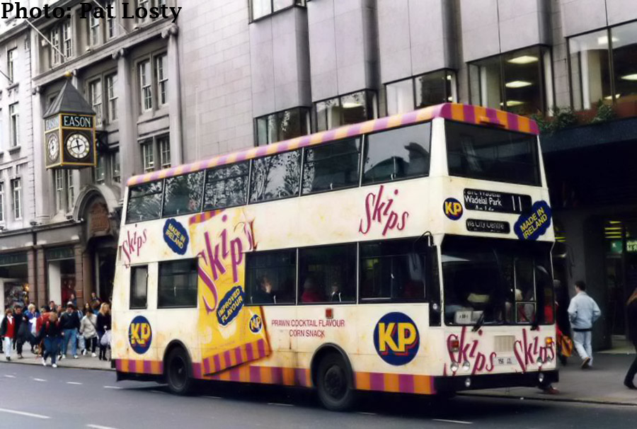
Bombardier KD156 is seen on a northbound journey of Route 11 on O'Connell Street in October 1991. The AOA is for KP brand Skips. KD156, like KD150 above, was delivered in 1982 entering service on Route 48A. When withdrawn it saw time as a driver trainer before going into private preservation.
On the 3rd January 1955 Route 11 was extended further along the Clonskea Road to a new terminus on the corner of Bird Avenue. To turn about at the Bird Avenue terminus the buses used the triangle formed at the junction of Bird Avenue and Roebuck Road, turning in a clockwise manner and terminating on Bird Avenue outside the shops there.
The 60s brought Dublins traffic to a standstill and heralded a wave of one-way street initiatives in order to compensate for the growing amount of traffic on the citys streets. On Wednesday the 16th December 1964 Parnell Square was made one way, resulting the Route 11 being modified on its northbound routing to serve OConnell Street, Parnell Street, Parnell Square West, Parnell Square North, North Frederick Street, Dorset Street with the southbound routing unaffected.
The 11 was changed again in March of 1965 when Stephens Green was made one-way on the 25th. This date also saw the one-way circus or loop at Leeson Street Upper and Sussex Road introduced as per the current arrangements. The 11s city centre routing was now as follows:
Northbound: The Appian Way, Leeson Street Upper, Leeson Street Lower, St. Stephens Green South, Saint Stephens Green West, Grafton Street, Suffolk Street, Church Lane, College Green, Westmoreland Street, OConnell Street, Parnell Street, Parnell Square West, Parnell Square North, North Frederick Street, Dorset Street Lower.
Southbound: Dorset Street Lower, North Frederick Street, Parnell Square East, OConnell Street, Dolier Street, College Street, Grafton Street, Nassau Street, Dawson Street, St. Stephens Green North, St. Stephens Green East, Leeson Street Lower, Leeson Street Upper, Sussex Road, Leeson Street Upper, The Appian Way.
Van-Hool bodied Leyland Atlantean AN68, DF617, is seen operating Route 11 loading passengers at the St. Stephen's Green North stop on the 11th March 1994. Traffic around the green at this time was clockwise, the Luas was a decade away. DF617 would not have long left in the Dublin Bus fleet, being withdrawn 3 months after this photo was taken after 18½ years service.
The 11A variant of route 11 began in 1965, sometime between April and June. It operated from the 11s northern terminus of Ballymun Road (Mobhi Road) via Route 11 to Clonskea Road then:
Roebuck Road, Foster Avenue (terminating by reversing into Owenstown Park).
On Wednesday 25th May 1966, Leeson Street Lower between Hatch Street and Stephens Green was made one-way. Due to this the 11s were once again changed, though this time only on the southbound routing, which in part became:
Dawson Street, St. Stephens Green North, Merrion Row, Baggot Street, Pembroke Street Lower, Fitzwilliam Square West, Pembroke Street Upper, Leeson Street Lower, Leeson Street Upper, Sussex Road, Leeson Street Upper, The Appian Way.
The northern terminus of Routes 11/A was changed in the first half of 1967 (sometime between February and June) to terminate at Mobhi Road (Cnr Griffith Avenue). This may well have been due to works within the area, which saw an extension to Griffith Avenue beyond Mobhi Road where it had previously stopped. By 1969, again sometime between February and June, the 11/A northern terminus was changed to Griffith Avenue. The buses turned left off Mobhi Road onto a new section of Griffith Avenue before terminating, then it used the triangle (Griffith Avenue/Ballymun Road/Mobhi Road) to turn about.
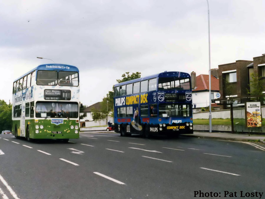
A once in a lifetime shot of both D755 and D757 on Griffith Avenue on the 30th August 1986. Both vehicles being in AOA shows how prevelant AOA buses were on Route 11. D757, like D756 was used for a Philips AOA, but this time for the incredibly revolutionary Compack Disk (CD). It would spend time with D756 in Cork, D724 and 725 going to Donnybrook in return. D755 is in AOA for Bailieborough Daries products. It did not have long left in this AOA. A few months later Avonmore tookover Bailieborough and the AOA was removed due to the brand no longer being used. D757 would be withdrawn in 1993, while D755 would soldier on into 1994. This photo also shows the arrangement on the 11s Griffith Avenue terminus. The shelter there was on Griffith Avenue, the housing behind is Hillcrest Court. The maroon car behind the bus is on Griffith Avenue awaiting the lights at Mobhi Road. The 11A, terminating at Griffith Avenue, would follow one-way traingle of roads back to the St. Mobhi Road on its return to Mather Road North.
On the 29th October 1969 North Frederick Street was made one way towards O'Connell Street, with Granby Row made one way outbound, to complete the current arrangement. Route 11's North city routing outbound therefore became: O'Connell Street, Parnell Street, Parnell Square West, Granby Row, Dorset Street Upper, Dorset Street Lower.
University College Dublin (UCD or is that UCDD??) was quite like how the Dublin Institute of Technology (DIT) is currently, in that it was spread around many buildings in the city centre of Dublin. The headquarters of UCD was on Earlsfort Terrace (National Concert Hall) , while other locations used were Cecilia Street, College of Science Merrion Street (now home to the Department of the Taoiseach), and Newman House on St Stephen's Green. It wasnt until the 60s that work began on providing an all encompassing campus for UCD on the Belfield site. It was even later that the growing body of students would be provided with a bus service onto the campus itself.
On Monday 27th January 1970 Route 11B started, and along with an extension of Route 10 from the same date, brought the first bus services to Belfield Campus. Route 11B only ran from Parnell Square East to Belfield via Route 11 before serving Wynnsward Drive into the campus to terminate at its current terminus location. Interestingly Route 10 also terminated here initially. Neither the flyover nor the current main entrance road into Belfield were completed and thus route 10 ran via Stillorgan Road, Foster Avenue and Owenstown Park before terminating with the 11B.

Bombardier KD277 is seen operating Route 11B incorrectly scrolled heading to its Wadelai Park terminus. It's seen turning left off the Ballymun Road onto St. Pappin's Road.
The use of Owenstown Park as a principal entrance into the new UCD campus no doubt lead the use of this road by Route 11A to turnabout being withdrawn. In late 71/early 72 (sometime between September and February), the 11A was extended to its current terminus on Mather Road North. Routing from Clonskeagh Road was as follows:
Clonskeagh Road, Roebuck Road, Callary Road, Mather Road North (terminate), North Road, Foster Avenue, Roebuck Road, Bird Avenue (serving 11 terminus), Clonskeagh Road.
Grafton Street was long known as the shopping heart of Dublin. This bustling street is famous in many songs, stories and poems about Dublin. However, the street was also one of the main thoroughfares of Dublins city bus network; hardly ideal. An original plan was proposed in 1971 to pedestrianise the street, however this was met with opposition due to its effects on bus schedules and from local traders possibly worried about the foot traffic lost from losing bus services.
On December 1st 1982 Grafton Street was finally pedestrianised. Traffic arrangements were modified, principally Dawson Street reversed to be one-way for south-bound traffic and Kildare Street was reversed to be one-way northbound, while Nassau Street after a bit of reconstruction was made two-way again between the junctions of Dawson Street and Suffolk Street. Hence the south city routing of the 11 group of services became:
Sounthbound: Dolier Street, College Street, Grafton Street, Nassau Street, Leinster Street South, Kildare Street, St. Stephens Green North, Merrion Row, Baggot Street.
Northbound: St. Stephens Green West, St. Stephens Green North, Dawson Street, Nassau Street, Suffolk Street, Church Lane, College Green, Westmoreland Street.
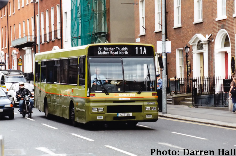
Alexandra Setanta bodied DAF SB220, AD19, is seen operating Route 11A to Mather Road North on Parnell Square East shortly after being painted into two-tone green in the Summer of 1997. AD25 had been first to painted out of its Cityswift livery into a single-deck equivalent of the trial livery applied to RH86 (see below). However this proved unpopular and AD19 reverted to the then core livery until an alternative livery was chosen. This bus would end its days in Phibsborough, and upon withdrawal would see further service with Bus Eireann on school duties.
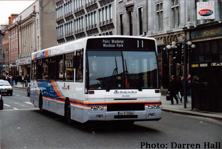
Wadelai Road and Green form part of an estate off the Ballymun Road opposite Dublin City University. Work on the first part of this estate began in 1945. By 1948 Route 13 was operating to Wadelai Park. This with many of Dublins bus destinations requires some explanation. Wadelai was the name of a fort on the River Nile in the former Egyptian province of Equatoria, now in Sudan. A house, owned by William Ellis, was called Wadelai in the early 1900s. The lands in this area then became part of a scheme whereby the unemployed in Dublin where given allotments to work on by the City Council in the mid-1930s, the area again being known as Wadelai. Though only speculative, this may have been the reason for the name Wadelai Park, as no road in the estate is actually called Wadelai Park.
With the growing suburbs of Ballymun and Poppintree, CIE began operating some 13s to Ballymun Roundabout, denoted as 13A sametime in the mid-to-late 70s. Then in 1980 Route 13A was extended to Poppintree, the first bus service to this vast expanse of council housing. The 13 was then extended to Ballymun via Wadelai Road, cutting out the section of the 13 route further up St. Pappins Road to St. Pappins Green. This rerouting of the 13s did not find favour with the residents in Wadelai who were unhappy that the buses were reaching their estate already full.
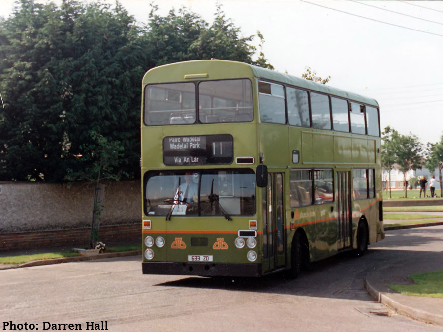
Then sometime between November 1983 and January 1984, the 13s were removed from Wadelai Park to serve Poppintree, while Route 11 was extended to Wadelai Park. The terminus was slightly different to the old 13 terminus at St. Pappins Road/Green. Turning left off the Ballymun Road to St. Pappins Road they used the square of Maolbuille Road, Wadelai Road (terminus at Green there), Delville Road, St. Pappins Road to terminate.
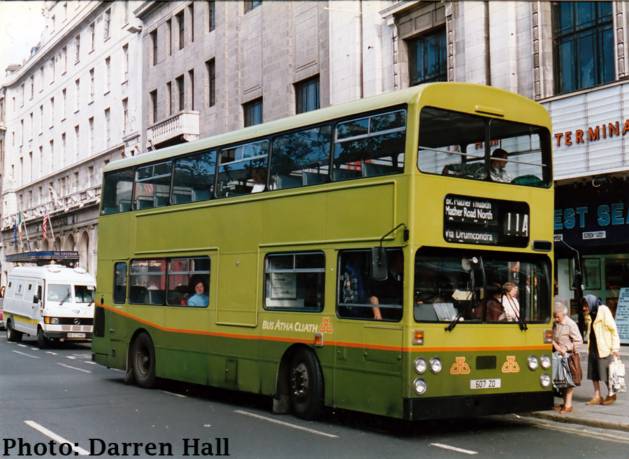
However it should be noted that initially only just over 1 in 3 services went Wadelai Park, with the 11B extended to join Route 11A at the Griffith Avenue terminus and a new 11C being introduced operating from Parnell Square East to Sandyford Industrial Estate with one return service in the morning peak. Following Route 11 to Roebuck Road the 11C continued on down the Goatstown Road, Kilmacud Road Lower, Kilmacud Road Upper, Kilmacud Road Extension, Blackthorn Avenue, Blackthorn Road, Carmanhall Road, Corrig Road (terminus). In the late 1970s the 11A had seen a great increase in the number of services running to Mather Road North, especially in terms of services just from the city. Therefore in this new timetable, the routes were run as Wadelai Park to Clonskea (Bird Avenue) and Griffith Avenue to Mather Road North, with about a 50/50 split, with 11B very much predominantly Griffith Avenue to Belfield. Buses heading south displayed their respective numbers but on the northbound displayed either 11 for Wadelai Park services or 11A for Griffith Avenue only services.
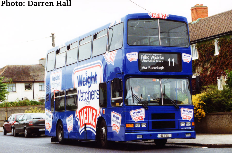
Alexander R-bodied Cummins Engined Volvo Olympian, RA190, is seen awaiting time at Route 11's Wadelai Park terminus on the 5th July 1998 in Heinz Weight Watchers AOA.
This setup proved unpopular and by early 1985 most 11As had gone, with the service reduced to just 11 departures from Mather Road North. However, there was only a slight increase in the number of services to Wadelai Park. The terminus at Wadelai Park was also changed at this point. Buses from Ballymun Road followed St. Pappins Road, to the old 13 terminus on St. Pappins Road using St. Pappins Green to reverse into the terminus.
Also between 1984 and 1986 saw the opening of the contra-flow bus lane along Leeson Street. One may street amendments in the mid-60s had diverted all Leeson Street bound buses down Baggot Street, serving Fitzwilliam Square to get back onto Leeson Street. Therefore buses travelled via St. Stephens Green North, St. Stephens Green East and Leeson Street on their outbound thus having a much more parallel city inbound and outbound routing.
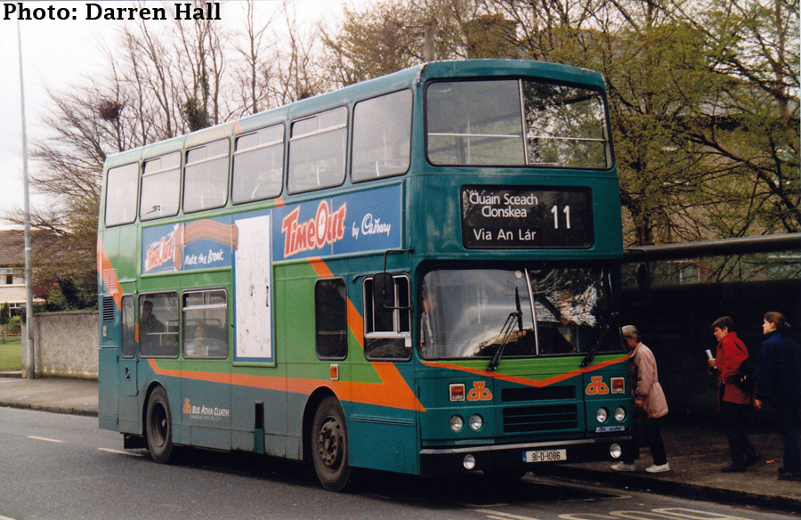
Alexander R-bodied Leyland Olympian, RH86, is seen operating a Route 11 departure to Clonskea on the Ballymun Road while in a trial Dublinbus livery in 1997. The livery proved unpopular with a blue and cream livery been chosen. This bus is still with Dublinbus as an Open-Top on the Hop-On Hop-Off Dublin City Tour.
On December 14th 1987 there was a significant increase in the amount of services to Wadelai Park. All weekend services (11/A/B) went to Wadelai Park, while Griffith Avenue was kept as a terminus Monday-Friday with just less than half of the buses terminating there. At this point route 11B was modified on its inbound journey to serve the 11 terminus at Bird Avenue. Departing Belfield buses turned left off Wynnsward Drive before using the triangle at Bird Avenue to turn back towards the city. Route 11C was also cancelled from this date (well Friday December 11th was the last official day of operation) with some peak hour Route 62 services diverted to serve Sandyford Industrial Estate to compensate.
During the late 1980s, a significant development was the roll-out of One Person Operated (OPO) services. The 11 was one of the last crew-operated routes that saw into the 90s. Unions and Dublin Bus finally agreed in July 1990 that OPO services could begin on Route 11 but that all remaining conductors could continue to work but would not be replaced on retirement.
The 11 route was modified at its Wadelai Park terminus to its current form due to the fact that OPO services would be unable to perform the reversing movement. From the Ballymun Road buses turned left to St. Pappins Road, right onto Delville Road, left Glasnevin Park, left St. Pappins Road to terminus on St. Pappins Road prior to junction with St. Pappins Green. Returning buses followed St. Pappins Road to Ballymun Road. At this point Griffith Avenue was also removed as a terminus location.
Van Hool bodied Leyland Atlantean AN68, DF633, is seen on St. Pappin's Road, following the road around to the left to its terminus just prior to St. Pappin's Green on the 13th June 1992. Hilcrest Park is seen in the rear of the photo. D633 was originally a Cork Bus operating from Capwell garage, before being sent to Dublin Bus in 1988. It received its DAF engine before entering service in Donnybrook, the engine taken from withdrawn Atlantean PDR1A/1 DF408 It was withdrawn in the Summer of 1993 after the delivery of Olympians RH146-9 to Donnybrook.
Due to a significant order of 80 AD class (Alexander Setanta bodied DAF SB220s) in 1994, 37 of which would be working in Donnybrook by the year's end, and a reluctance to convert a flagship route to a single-deck high-frequency service left Donnybrook with a lot of new-single deckers to place into service. They decided to allocate them to previously Double-Deck only routes such as the 3, 14s, 18, 54A, 62 and of course the 11. This was the first time the 11 would be operated by single-decks, though double-decks were there to lend a hand. The ADs would finally be phased off the 11 route with new deliveries of RVs in the late 90s.
On the 8th March 1999, Route 11 was amalgamated with Route 62 and extended to the latters Kilmacud terminus. The routing at this point was:
Southbound: Wadelai Park (St. Pappins Road), St. Pappins Road, Ballymun Road, St. Mobhi Road, Home Farm Road, Drumcondra Road Upper, Drumcondra Road Lower, Dorset Street Lower, North Frederick Street, Parnell Square East, OConnell Street, Dolier Street, College Street, College Green, Grafton Street, Nassau Street, Leinster Street South, Kildare Street, St. Stephens Green North, St. Stephens Green East, Leeson Street Lower, Leeson Street Upper, Sussex Road, Leeson Street Upper, The Appian Way, Chelmsford Road, Sandford Road, Clonskea Road, Roebuck Road, Goatstown Road, Kilmacud Road Lower, Drummartin Road, Lower Kilmacud Road, Kilmacud terminus (near Stillorgan S.C.).
Northbound: Kilmacud, Lower Kilmacud Road, Drummartin Road, Lower Kilmacud Road, Goatstown Road, Roebuck Road, Clonskea Road, Sandford Road, Chelmsford Road, The Appian Way, Leeson Street Upper, Leeson Street Lower, St. Stephens Green South, St. Stephens Green West, St. Stephens Green North, Dawson Street, Nassau Street, Suffolk Street, Church Lane, College Green, Westmoreland Street, OConnell Street, Parnell Street, Parnell Square West, Granby Row, Dorset Street Upper, Dorset Street Lower, Drumcondra Road Lower, Drumcondra Road Upper, Home Farm Road, St. Mobhi Road, Griffith Avenue, Ballymun Road, St. Pappins Road, Delville Road, Glasnevin Park, St. Pappins Road (Wadelai Park).
Alexander ALX400 bodied Volvo B7TL, AV69, is seen at the 11's Kilmacud terminus of the 27th October 2000 when new in service. AV69 was first of the batch AV69-88 which were delivered to Donnybrook and primarily put to service on the 11s converting them to low floor. The Kilmacud terminus was the former 62 terminus to which the 11s were extended upon amalgamation with the 62 in 1999.
This also saw a number of services in the peak periods via Sandyford Industrial Estate. Like those services on the 62 before, they went against peak traffic as such, outbound in the morning peak and inbound in the evening peak. There were also interesting variants that started in OConnell Street following more of Route 62, in that they served Kellys Corner, Charlemont Street and Ranelagh Road on the way to Kilmacud via Sandyford Industrial Estate. The buses via Sandyford Industrial Estate ran as Route 11C had done:
Kilmacud Road Lower, Kilmacud Road Upper, Kilmacud Road Extension, Blackthorn Avenue, Blackthorn Road, Carmanhall Road, Corrig Road, Blackthorn Road, Blackthorn Avenue, Kilmacud Road Extension, Kilmacud Road Upper, Kilmacud Road Lower.
The Kellys Corner services would not last long being withdrawn on the 7th February 2000.
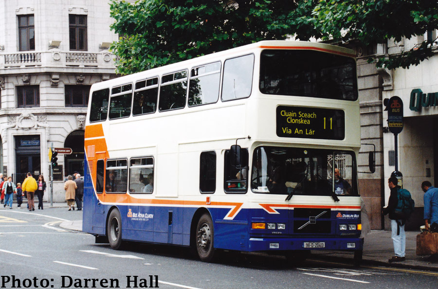
Alexander R-boded Volvo Olympian, RA178, is seen alighting passengers on O'Connell Street on the 14th June 1998. RA178 is notable in that it was the first bus to be painted into what was to become the standard fleet livery of blue and cream in November 1997. Interestingly in the 1960s, CIE replaced their green livered buses with a blue and cream livery, albeit with a darker blue.
The year 2000 brought about the first low-floor double-deck vehicles in the Dublin Bus fleet. Whereas many of the initial vehicles went into service partially convering certain routes, Donnybrook assigned the batch of AV69 to 88 straight onto the 11's converting the whole route. This makes Route 11 one of Dublin's first fully low-floor routes, the 222 and 300 being the first.
As part of traffic management changes required for the completion and opening of the LUAS tram green line on St. Stephens Green West, northbound route 11 buses were diverted as follows from the 4th July 2004:
Leeson Street Lower, St. Stephens Green East, St. Stephens Green North, Dawson Street.
In the new traffic flow the flow on St. Stephens Green East was reversed to be northbound, but a contra-flow bus lane was kept for buses heading southbound, St. Stephens Green North was eastbound only between Kildare and Dawsons Street, two way the rest, and St. Stephens Green West where the LUAS terminates was changed such that there was no through road.
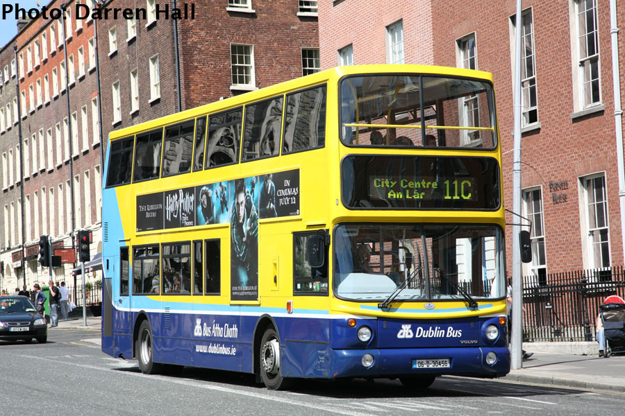
Alexander Dennis ALX400 bodied Volvo B7TL, AX456, is seen operating Route 11C on Parnell Square East on the 31st July 2007. This number relates to the old services to Sandyford Industrial Estate, however noawadys the number is just used to denote services which operate to the City Centre only.
Special thanks for this article must be given to renowned bus photographers Darren Hall and Patrick Losty for their excellent pictures. Darren Hall, in collaboration with Johnathan McDonnell and Ian Molloy, has published two books celebrating the 20th anniversary of Dublin Bus and Bus Eireann in 2007. Both books are mandatory in any Irish Transport collection. Patrick Losty has, in collaboration with Dublinbus.cc, and formerly dublinbuses.com, created a series of online features covering year by year of Dublinbus' 23 year existence. Entited Wheeling in the Years it amasses a fantastic historical account of the companies existence through its vehicles. Pat is also currently (March 2010) compiling a series of 31 photos for a KD-month celebration on dublinbus.cc. Visit daily for the updates.